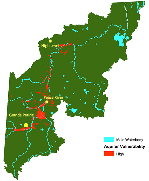
Groundwater QualitySurficial aquifers exhibit extensive variability in depth, extent and quality. They tend to have the best water quality, but are also the most vulnerable to contamination because they are near the surface and often covered by material that has high infiltration rates. Groundwater in shallow aquifers retains many of the characteristics of the infiltrating surface water, and can become a pathway for contaminants to reach groundwater after rain. For example, viruses and bacteria (such as E. coli) associated with livestock manure production may pose a threat to the water source. Contaminants can travel with runoff or stream water and infiltrate a shallow aquifer some distance away. Further groundwater movement could carry the contaminants to a drinking water source. Tracking where contaminants originate is difficult, and those who rely on shallow wells for drinking water need to understand the highly variable and sometimes vulnerable nature of shallow groundwater. Only the areas where most of the watershed's population and human development are located have been mapped for aquifer vulnerability. This mapping should be expanded to the rest of the watershed. In deeper aquifers, water quality tends to decline and become saline. Saline groundwater (TDS > 4,000 mg/L) is used for industrial purposes. Allocation of saline groundwater is under the jurisdiction of the Alberta Energy Regulator (AER), which will phase out the usage of freshwater for oil field injections for in situ and SAGD operations.
|
Aquifer Vulnerability
|
| © 2015 Mighty Peace Watershed Alliance | CONTACT THE ALLIANCE |
NEXT PAGE: Wells |