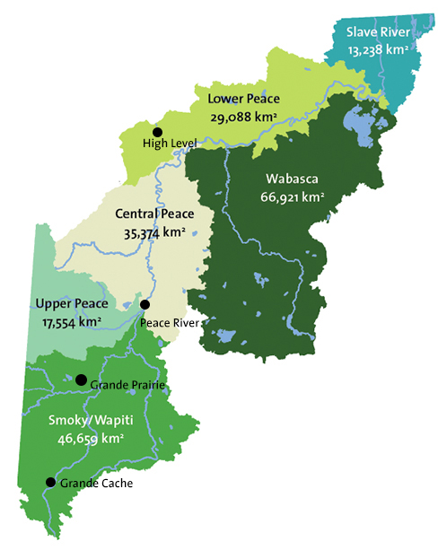
Sub-watersheds at a GlanceChoose a sub-watershed on the map at right for details about the sub-watershed's demographics, settlement patterns, human footprint, water allocations and wetland cover. NotesAll population data were derived from Canada Census 2011. Where Métis settlements or reserves occupy parts of more than one sub-watershed, populations may have been assumed to be divided equally among sub-watersheds. Percentages may not always total 100% due to rounding. Industrial water allocation is for oil and gas operations. Watershed Management Allocation is the license for water used to create habitat and manage lakes and/or wetlands among other things. |
|
| © 2015 Mighty Peace Watershed Alliance | CONTACT THE ALLIANCE |
NEXT PAGE: Smoky/Wapiti Sub-watershed |