| |
Historical Water Levels in
La Crete Deeper Aquifer
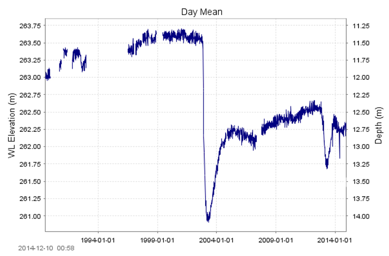
The deeper (83.5-metre) aquifer near La Crete, shown in the chart below, indicates two clear decreases in aquifer water levels. In this case, groundwater levels fell rapidly, with a slower recovery. Groundwater levels have not returned to normal levels in this aquifer. |
|
| ? |
INFO GAP |
| Expansion of the Groundwater Observation Well Network program is needed in anticipation of rising water demand from industries and a growing population, particularly in the Smoky/Wapiti and Wabasca , which account for 80% of groundwater allocation in the watershed. The southern Wabasca is a hot spot for in situ oil sands operations, as is the region east of the town of Peace River. In the near future, pilot projects are expected to begin operating at Husky's McMullen and Cenovus Energy's Pelican Lake, and Shell has one in production at Carmon Creek. There is no evidence industrial and commercial usage is affecting the quantity of groundwater in the southern Wabasca, although that may be due to insufficient data. |
|
|