Peace River FlowMuch of the water feeding the Peace River originates in the mountains and foothills, where the Smoky and Wapiti tributaries begin. These areas are particularly important for protecting the freshwater supply and should be carefully managed. The map at right shows high water-yield areas for the Mighty Peace watershed (those with the top 25% yields per square kilometre in the entire watershed). These areas generally have a surplus of water, which benefits downstream rivers and lakes. The Peace is considered a "regulated" river because it is controlled by dams. The largest of these, the W.A.C. Bennett Dam, has changed the natural flow of the Peace River. As shown in the chart on the following page, the dam has levelled the flow, making it lower in summer and higher in winter. Peace River flows at Dunvegan (above the confluence with the Smoky River) show a change following dam commissioning in 1968. Since then, there has been no long-term change. The impact of the dam can be considered when management practices that adjust the flows are contemplated. The specific effects of the dam on aquatic ecosystems of watersheds have not been fully characterized. Average flow in the Peace River from 1977–2010 (Historical records from 4 stations) |
High water-yield areas18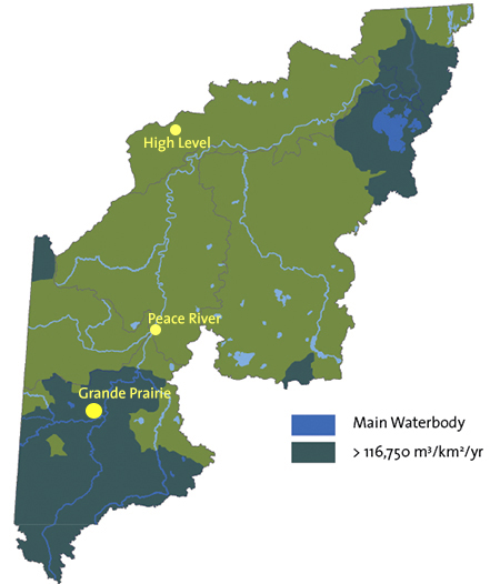 Source: ESRD
| |||
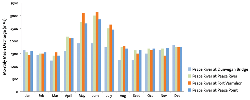 Source: Water Survey of Canada | ||||
| © 2015 Mighty Peace Watershed Alliance | CONTACT THE ALLIANCE |
NEXT PAGE: Dams on the Peace |