Seasonal patterns in groundwater and flow rates | ||||
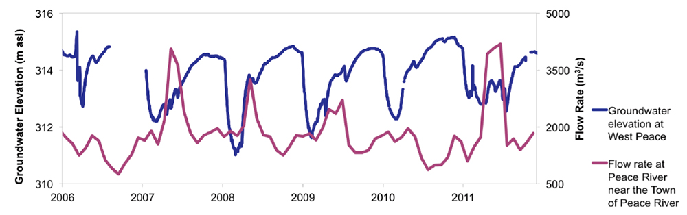
| The chart below demonstrates interesting patterns from the Groundwater Observation Well Network dataset, showing the value of the network and the need for a more extensive groundwater network. This shallow gravel aquifer, located on the western bank of the Peace River at the town of Peace River, shows the seasonal patterns of groundwater elevation compared to the river's flow rate. |
||||
|
||||
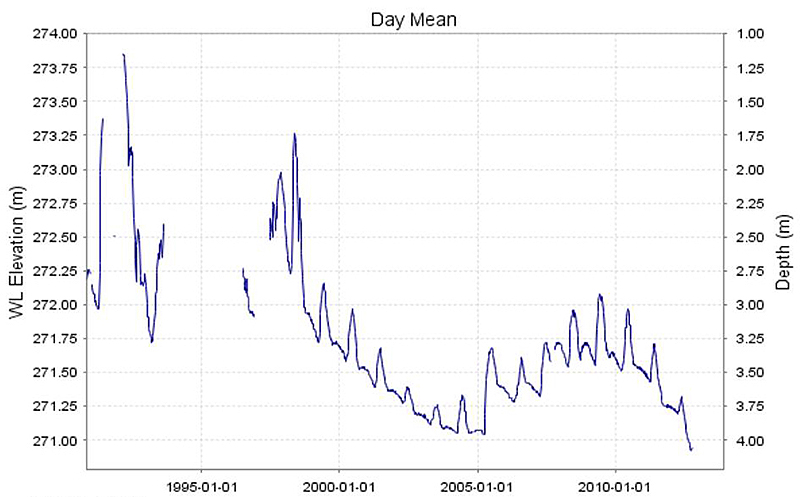
Historical Water Levels in La Crete Shallow AquiferAs shown in the next chart, the shallow (8.5-metre) aquifer near La Crete appears to be under long-term stress (approximately 20% reduction in original available supply). Further study is required to determine the causes of this decrease and its sustainability over time. |
||||
Source: ESRD
|
||||
| © 2015 Mighty Peace Watershed Alliance | CONTACT THE ALLIANCE |
NEXT PAGE: La Crete Aquifer |